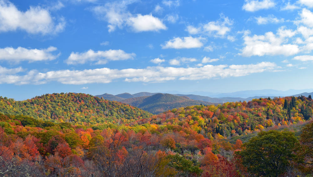
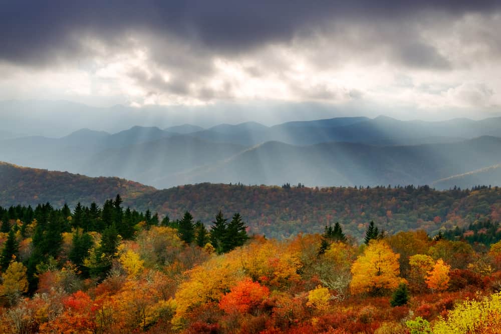
If you’re seeking North Carolina fall colors, there are many beautiful, scenic drives in North Carolina, especially Western North Carolina, where you can experience vibrant fall foliage as part of a stunning landscape.
Since so many North Carolinians head toward the mountains for fall colors (for good reason) we reached out to ExploreAsheville.com for advice. They generously shared some recommended routes, and some breathtaking pictures, with us. They have even separated the routes by time of season, since the leaves in higher elevations change first.
The North Carolina mountains are the best place to start for fall colors, but keep reading for information on scenic drives for fall color close to Charlotte.
Also, for those who want to really stay close to home, here’s a collection of pictures and an interactive map of fall colors in Charlotte. You can even add to the map!
You might also be interested in:
- Subscribing to Charlotte on the Cheap's email list
- Charlotte on the Cheap Deals
- Free and cheap things to do this week
- Scenic drives for fall colors in the North Carolina mountains and Piedmont
- Charlotte Hotel Deals
- 8 self-guided walking tours in Charlotte
- Hike through the woods to another time -- the Robinson Rock House ruins from the 1700s
- Evergreen Nature Preserve: walk through an unspoiled hardwood forest in Charlotte
- Big Rock Nature Preserve
- 7 must-see Charlotte area gardens
- Guide to Charlotte's historic cemeteries
- Photo guide to 7 breathtaking North Carolina waterfalls
- Photo guide to hiking at 8 North Carolina State Parks
- Charlotte area farmers markets
One of the most useful resources for planning your trip to the North Carolina mountains for fall color is Explore Asheville’s Fall Color Map & Fall Leaves Schedule.
Follow the above link, and drag the red dot on the time line to see the projected peak color, starting in late September, move across the mountains. The actual dates depend on weather conditions, and Explore Asheville might tweak the map as the season progresses, but bottom line: at the highest elevations, visit in early October, and in lower elevations peak leaf watching dates are probably from late October to early/mid November.
You might also find the foliage map on smokymountains.com/fall-foliage-map useful for visualizing when different places will start to experience fall colors.
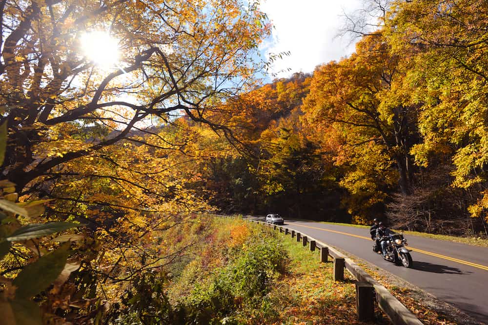
All of the drives described below start in or near Asheville, which is about a two hour drive from Charlotte. All of these routes are from ExploreAsheville.com and used with permission.
Early Fall Scenic Drives in the North Carolina Mountains
You’ll find more details on these early fall scenic drives, as well as maps, on ExploreAshville.com.
Grandfather Mountain/The High Country: There are several ways to get to Grandfather Mountain from Asheville, and all will be beautiful.
- Option #1: Take I-40 East to Marion, then Hwy 221 north to Linville Falls at milepost 316.
- Option #2: Take I-40 east to Morganton, then Hwy 181 north to the Parkway, passing Table Rock on the way.
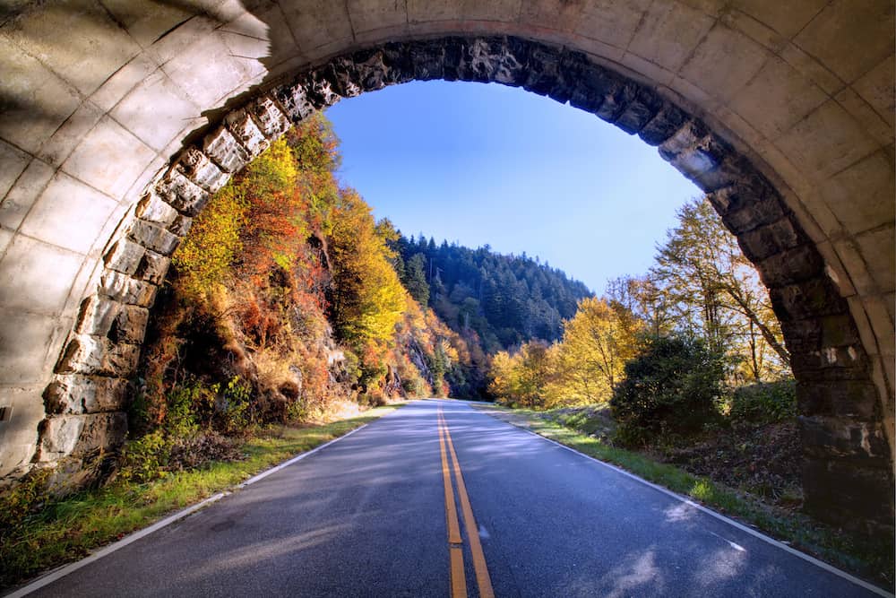
- Option #3: (Closed until early Fall 2025) Take the Blue Ridge Parkway north from Asheville and visit Craggy Gardens on the way at milepost 364, and then marvel at the Linn Cove Viaduct (pictured above) at milepost 304. Craggy Gardens and Craggy Pinnacle Trail remain closed until further notice due to the impact of Hurricane Helene. Visit the National Park Service website for current Blue Ridge Parkway road conditions, and refer to our open trail guide to find the perfect hike for you on the BRP.
Pisgah National Forest: Take the Blue Ridge Parkway south from Asheville toward Mount Pisgah at Milepost 408, where you will find picnic areas, hiking trails and the popular dining room at the Pisgah Inn, with its perfect view of Looking Glass Rock. At milepost 411, turn onto US 276 toward Waynesville. You will pass through the magnificent Pisgah National Forest, which affords a spectacular view of Cold Mountain, made famous by the novel and motion picture of the same name. Continue into Waynesville and circle back to Asheville.
U.S. Highway 19: From Asheville, take US 19/23 north from downtown, and follow 19E to Burnsville. If you have time, take a break in Burnsville to enjoy its quaint shops and galleries. Then, continue your drive along 19E to the town of Spruce Pine, stopping along the way to visit the North Carolina Museum of Minerals and to enjoy the spectacular views of the Black Mountains and Mount Mitchell, the highest peak in the eastern U.S. at 6,684 feet.
*Mountain Mitchell State Park remains closed until further notice due to the impact of Hurricane Helene. Visit NCParks.gov for the latest information on the park and trail status.
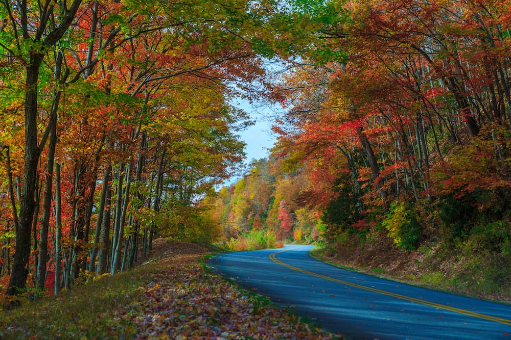
Mid-Fall Scenic Drives in the North Carolina Mountains
You’ll find more details on these mid-fall scenic drives, as well as maps, on ExploreAshville.com.
Waterfall Country: For the waterfall fan! Start out by going south on the Blue Ridge Parkway from Asheville, and then exit at Milepost 411 to US 276. Follow US 276 to the south, and you’ll get to Sliding Rock. It might be too cold to slide down the rock in the fall, but it’s still very scenic. Also, visit the Cradle of Forestry and Looking Glass Falls. You can park at the Looking Glass Rock trailhead, and hike on a 3.1 mile trail, where you’ll be in the middle of stunning fall colors. Then, continue on 276 to 280 North to NC 191. This will take you along the banks of the French Broad River and back to Asheville.
Hot Springs: Take NC 63 west. You’ll past Leicester and Trust, and then take NC 209 to Hot Springs. Hot Springs is a charming town to explore, including Hot Springs Resort and Spa, with its natural hot mineral waters. Hot Springs has an entrance to the Appalachian Trail, so you can at least put a toe on the Trail. Then return on US 25/70 to Weaverville and take I-26 East back to Asheville.
Maggie Valley and Cherokee: US 19 from Maggie Valley to Cherokee boasts several excellent leaf-viewing sites along lovely winding roads. To get there take US 19/23/74 west from Asheville. A return trip to Asheville via US 276 through the Pisgah National Forest to the Blue Ridge Parkway offers many overlooks from which to enjoy the autumn panorama.
Late Fall Scenic Drives in the North Carolina Mountains
You’ll find more details on these late fall scenic drives, as well as maps, on ExploreAshville.com.
Reems Creek Valley: Take US Highway 19/23 north from Asheville to the New Stock Road exit 21. Turn right at the light and left at the next light. That will bring you to US 25. In less than a mile, turn right onto Reems Creek Road. Drive 5 miles to Zebulon B. Vance Birthplace State Historic Site. After your visit, turn left, go a half mile, and turn left again on Ox Creek Road. This will bring you back to the Blue Ridge Parkway. Turn south, back to Asheville.
North Carolina Arboretum: This destination will let you enjoy the fall colors by foot. The North Carolina Arboretum, at 100 Frederick Law Olmstead Way, Asheville, features 65 acres of cultivated gardens, and more than 10 miles of hiking and biking trails. It’s just south of Downtown Asheville, and within the Bent Creek Experimental Forest of the Pisgah National Forest, so it allows visitors to explore fall colors close-up.
Scenic Drives for Fall Color Closer to Charlotte
Although nothing beats the North Carolina mountains for fall color, there are also plenty of opportunities to enjoy the changing leaves closer to home. Any of our greenways or nature preserves are great choices, as are the botanical gardens in the Charlotte area.
And don’t forget about the user-created fall color map for Charlotte!
And here are some scenic drives close to Charlotte. All of these drives are designated Scenic Byways by North Carolina Department of Transportation. Read more about North Carolina’s Scenic Byways here.
Make sure to double check all directions on your mapping software or map!
Uwharrie Scenic Road: The drive between Charlotte and Asheboro takes you through the Uwharrie Mountains. These peaks were formed several hundred million years ago by volcanoes. Take N.C. 49 north from Concord to Asheboro. On the way out, you might want to take a little side trip to Reed Gold Mine, 9621 Reed Mine Road, Midland. Once you are in the Uwharrie area, two great places for hiking are Morrow Mountain and the trails throughout Uwharrie National Forest. If you make it all the way to Asheboro, the North Carolina Zoo is a great end point of the journey. If you’re back in Albemarle for the evening, and it’s “drive-in movie” season, make sure to check out one of North Carolina’s few permanent drive-in theaters, Badin Road Drive-In Theater.
Flint Hill Ramble: This remote and beautiful Scenic Byway beings on Flint Hill Road (S.R. 1306), northeast of the Uwharrie community in Montgomery County. If you’re driving the Uwharrie Scenic Road (above), you might want to check out Flint Hill Ramble as well. From N.C. 109, turn onto Ophir Road (S.R. 1303.) After five miles you’ll get to the Ophir community. Turn right onto Flint Hill Road. This stretch of road offers impressive mountain views. Two miles down the road there’s a shaded parking area and trailhead for the Uwharrie National Recreational Trail. Take the short hike up the trail for a great view of the Uwharrie Mountains. Then, continue along Flint Hill Road. A short distance later you’ll get a turn-off on the left. Take a quick walk from the car to get to Jumping-Off Rock, a rocky bluff that overlooks a stream and the Uwharrie National Forest. But, do not jump off the Jumping-Off Rock. It’s a very bad idea. This Scenic Byway ends where Flint Hill Road intersects with Lovejoy Road (S.R. 1310.)
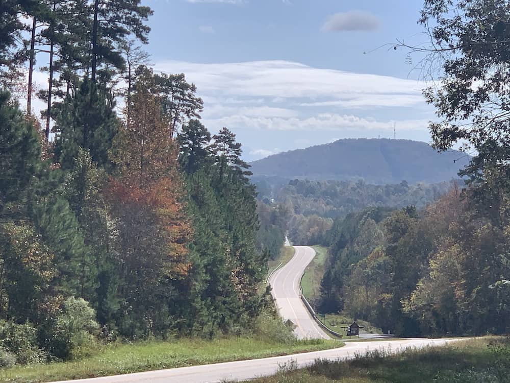
Crowders Mountain Drive: The Crowders Mountain Drive will take you by Crowders Mountain. Take Exit 10A from I-85 and follow U.S. 29/74. Exit onto Sparrow Springs Road (S.R. 1125.) This is where the Scenic Byway begins. From here it’s just an eight mile route, which will take you about 20 minutes. Continue on Sparrow Springs Road. It will veer right into the area around Crowders Mountain State Park. These are the closest mountains to Charlotte, and the most popular destination for hikers in the area. Keep following the byway by turning right to stay on Sparrow Springs Road for two miles. Then turn right onto Pinnacle Road. Then, Pinnacle Road changes to Lake Montonia Road (S.R. 2292.) Follow this road for one mile and will dead end. Turn right onto N.C. 171 (York Road) for a half mile, back onto I-85.
Hanging Rock Scenic Byway: In the northern Piedmont region, a highlight is Hanging Rock State Park. The Hanging Rock Scenic Byway offers a chance to explore the Sauratown Mountains. You’ll start near Winston Salem. From U.S. 52 (which you can get to from I-40), take exit 118 and follow N.C. 65 East. Then turn left to follow N.C. 66 North. When the intersects Denny Road, the Scenic Byway begins (staying on N.C. 66.) Drive 2.3 miles, then bear right on Flat Shoals Road.
Go five miles, then turn left onto Mountain Road. You’ll see excellent view of Hanging Rock on this section of the Byway. After four miles, turn left onto N.C. 8/89. This section of the route passes by the town of Danbury, which is on the Register of Historic Place. Just past Danbury, you have two route options to stay on the Byway.
The first: turn left on Hanging Rock Park Road and follow it as it becomes Moore Spring Road. This seven-mile stretch of road, offers several entry points into Hanging Rock State Park. When Moore Springs Road ends, turn left onto N.C. 66 and go five miles back to the Mount Olive community, where the Scenic Byway started.
The second option from just past Danbury: Continue on N.C. 89 for 25 miles to the Byway’s western end at Airsville Road in the Shelton Town community east of Mount Airy.
Rolling Kansas Byway: This 9-mile Scenic Byway through Stanly County features hilly terrain, turn of the century farms and windmills, and great views. From U.S. 52 in Richfield, turn onto South Main Street, which becomes Millingport Road. Go six miles through the countryside, and enjoy panoramic views fo the Western Piedmont. Turn right onto Bear Creek Church Road, and cross a bridge. You’ll pass near Bethel Bear Creek United Church of Christ, and its graveyard, with tombstones dating to the 1820s. The Byway ends at the Cabarrus/Stanly County line.
Pee Dee Valley Drive: This Scenic Byway runs parallel to the Pee Dee River, as it flows from Badin Lake to Lake Tillery. From the north, you can follow N.C. 740 from Albemarle to Badin, and turn onto Nantahala street. Then turn right onto Henderson Street (S.R. 1720.) The Byway begins at Badin Elementary School, 47 Henderson Street, Badin. Start traveling south. The name of the road will change to Valley Drive (you’ll still be on S.R. 1720.)
The Byway travels through the Pee Dee River Valley. You can take a side trip to Morrow Mountain State Park. Then continue along Valley Drive to the intersection of N.C. 24/27/73 East and turn left. Follow about two miles before turning right onto Indian Mound Road. Drive for six miles along Lake Tillery to Norwood.
You might also be interested in:
- Subscribing to Charlotte on the Cheap's email list
- Scenic drives for fall color in North Carolina
- Charlotte area hayrides, corn mazes, pumpkin patches
- Charlotte area haunted trails
- Halloween events in Charlotte
- Trick or Treat and Trunk or Treat events
- U-pick farms in the Charlotte area
- Farmers' markets in the Charlotte area
- Restaurant deals
- Free events this week
- Concerts this week in Charlotte
Subscribe to Charlotte on the Cheap